
What Is an Interactive Floor Plan? Definition, Examples and Benefits
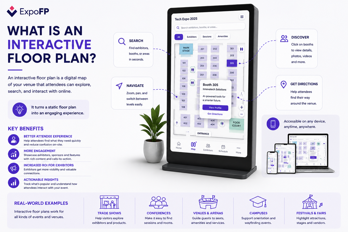
An interactive floor plan is a digital map of an event venue that users can search, zoom and navigate in a web browser. Attendees find exhibitors and sessions and get directions; organizers manage booth assignments, sales and analytics on the same map; exhibitors update their profiles and reserve booths on it directly. It replaces the static PDF plan with a live tool that stays current until — and during — the event.
That’s the definition. Here’s what it means in practice.
Interactive vs. static: the real difference
The failure mode of static plans is always the same: they’re obsolete by opening day, and attendees can’t use them at the exact moment they need them — standing in a loud hall, phone in hand, trying to find a specific booth.
How an interactive floor plan works
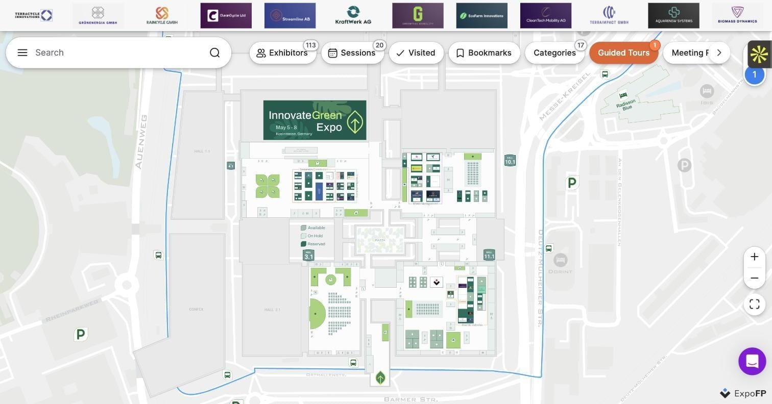
A modern interactive floor plan (like the ones ExpoFP hosts for events from local fairs to IMEX Frankfurt and Money20/20) has four essential elements:
1. The map itself. Drawn in a browser-based designer or converted from your venue’s CAD/PDF. Booths, aisles, stages, session rooms, cafés, restrooms, parking — anything findable is mappable. Multi-hall and outdoor areas included; some events even map shuttle bus routes.
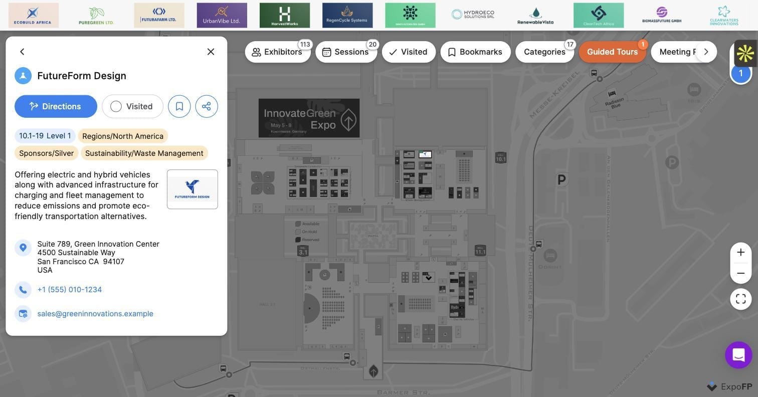
2. Search and wayfinding. Attendees search by company name, category or booth number and get walking directions from where they are — including “you are here” entry via QR codes placed around the venue. No app download; it works from a link or a QR scan.
3. The business. Every booth carries status, price and ownership. Exhibitors see live availability and can reserve or purchase directly on the map; each exhibitor gets a personal link to maintain their own profile (logo, description, contacts). Sponsored listings, featured placements and banners turn the map itself into a revenue stream.
4. Analytics. What attendees search for, which booths they view, how they move. Organizers use this to price next year’s floor plan; exhibitors use booth-view stats as ROI evidence.
Want to just try one? Open the live demo plan →
Who uses interactive floor plans — and for what
- Trade shows and expos — the core use case: booth sales, exhibitor directories, attendee navigation
- Conferences and summits — session rooms and stages mapped alongside the expo floor
- Festivals and fairs — vendors, stages, first aid and water points on outdoor grounds
- Corporate events — product launches, sales kickoffs, partner days
- Campuses and venues — open days, permanent venue maps
Across 10,000+ plans hosted by ExpoFP, the pattern is consistent: the interactive map becomes the single most-opened digital asset of the event, because it answers the only question every attendee has all day — “where is…?”
The benefits, by role
For organizers: one source of truth that never goes stale; booth sales without spreadsheet ping-pong; a new sponsorship inventory (the map itself); data for next year’s pricing. Organizers who switched report cutting floor-plan admin from a team of many to one or two people.
For exhibitors: being findable. An exhibitor on an interactive map is searchable by name and category, with a profile, and reachable by turn-by-turn directions — instead of being row 14, column 3 of a PDF legend.
For attendees: no app to install, no map to unfold. Search, tap, walk. Bookmark favorites, plan a route, get back to the right hall after lunch.
What to look for in interactive floor plan software
If you’re evaluating tools, the checklist that matters:
- Browser-based editing — you will change the plan 50 times; that must not require a designer or a support ticket
- No app requirement for attendees — adoption collapses behind an install wall
- Booth sales on the map — live availability, reservations, card payments
- Exhibitor self-service — 500 exhibitors should maintain 500 profiles themselves
- Analytics — searches, views, routes
- Multi-language support — essential for international shows
- Embeds and integrations — the map should live on your website and connect to your registration/event platform
ExpoFP checks all seven and is free to start — you can build your plan now and upgrade only when you’re ready.
FAQ
What is an interactive floor plan? A digital, searchable venue map where attendees find exhibitors and get directions, and organizers manage booth assignments, sales and analytics — all in a web browser, no app needed.
How is it different from a PDF floor plan? A PDF is a picture; an interactive plan is a tool. It’s searchable, always current, works on phones, sells booths and produces analytics. A PDF does none of that.
Do attendees need to download an app? No — a good interactive floor plan runs in any mobile browser via a link or QR code. That’s why adoption is dramatically higher than for event apps.
How much does an interactive floor plan cost? Pricing varies by event size and features. ExpoFP is free to start, with paid plans as your needs grow — see pricing.
Can exhibitors buy booths through the floor plan? Yes. On ExpoFP, available booths can be reserved or purchased by credit card directly on the map, with live availability visible to everyone.