10 Real Trade Show Floor Plan Examples That Actually Work
Most floor plan advice is theory. This isn’t.
Every example below is a real, live floor plan hosted on ExpoFP — from a 100-booth festival to Agritechnica’s 27 exhibition halls in Hannover. Explore how each layout is organized, why it works, and what you can borrow for your own event. Click through any example to experience it from an attendee's perspective.
What makes a floor plan “work”?
Four criteria we judged them by:
- Traffic flow — attendees naturally pass as many booths as possible, no dead ends;
- Anchor placement — stages, big brands and F&B pull people through the hall, not just to the entrance;
- Wayfinding clarity — logical numbering, clear aisles, landmarks to navigate by;
- Revenue density — premium spots maximized without suffocating the layout.
1. EXHIBITORLIVE 2026 — the classic grid, done right
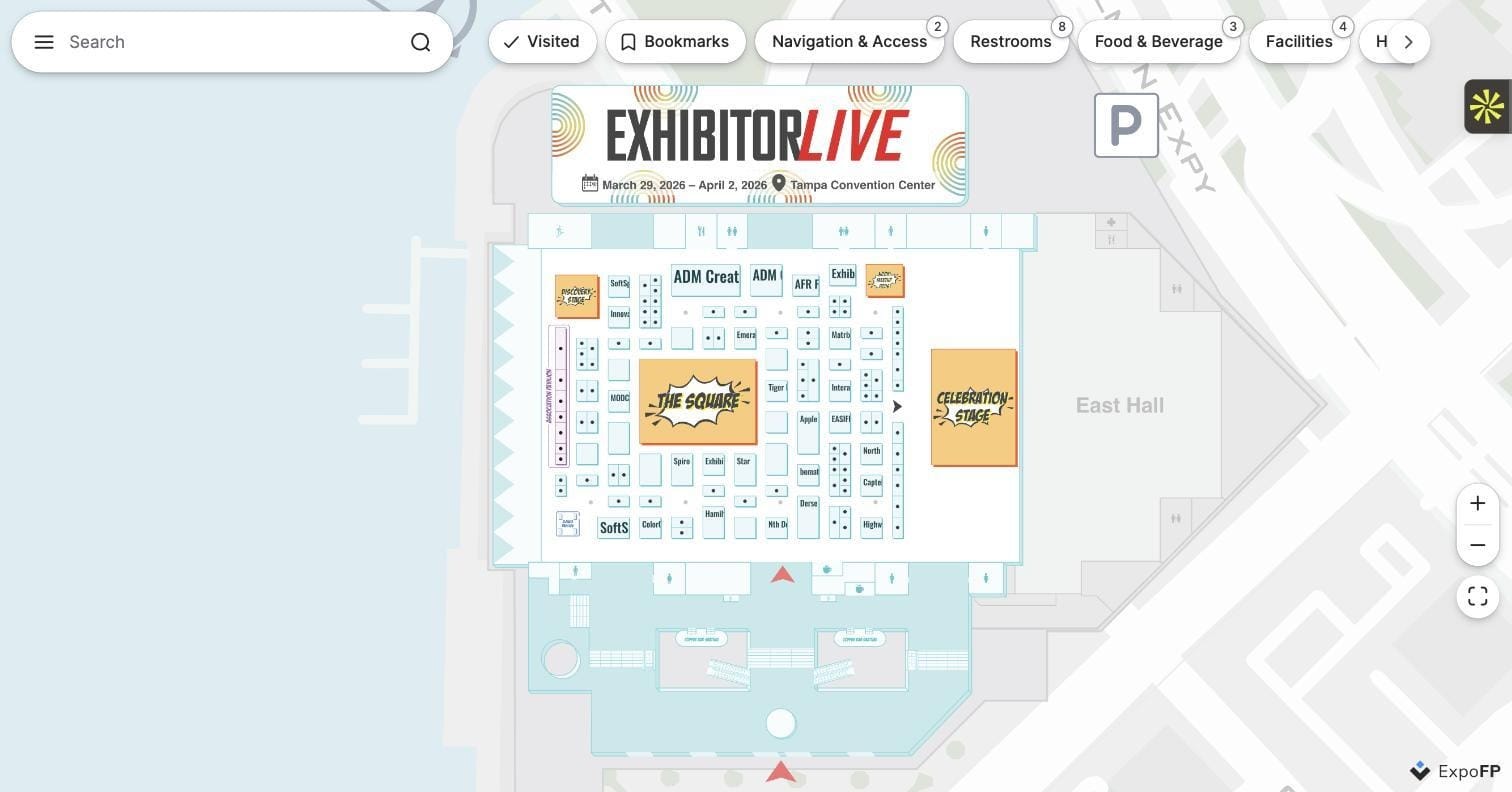
EXHIBITORLIVE 2026 trade show floor plan — grid layout with stage anchors at Tampa Convention Center
The trade show industry’s own show (Tampa Convention Center) runs on the workhorse layout: parallel rows of inline booths, anchored by three stages — Discovery Stage on one flank, Celebration Stage on the other, and “The Square” island in the center of the grid.
Why it works: the three anchors form a triangle, so traffic constantly crosses the grid between them instead of pooling at the entrance.
Copy this: place your stages at opposite ends and something social in the middle.
2. Surf Expo — a grid zoned into shoppable neighborhoods
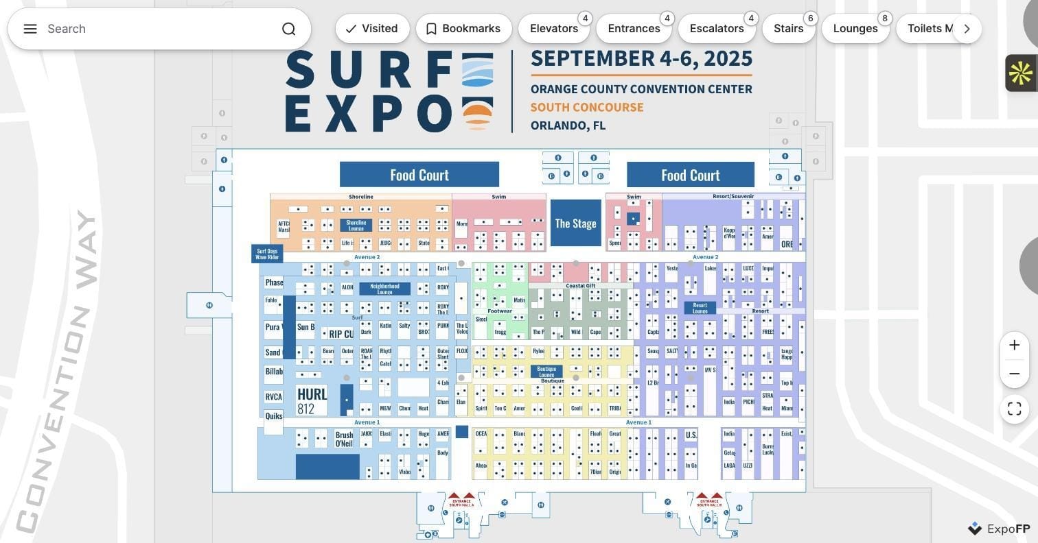
Surf Expo floor plan example — color-zoned grid with named avenues at Orange County Convention Center
Surf Expo (Orlando) takes the same grid and slices it into color-coded product neighborhoods — Shoreline, Swim, Footwear, Coastal Gift, Resort — connected by named “Avenues” with lounges at the seams and two Food Courts holding down the top corners.
Why it works: buyers shop by category; zones turn a 1,000-booth hall into six manageable shops. Named avenues make booth directions human: “Avenue 2, past the Resort Lounge.”
Copy this: name your aisles — it’s free wayfinding.
3. Money20/20 USA — the conference expo as a city
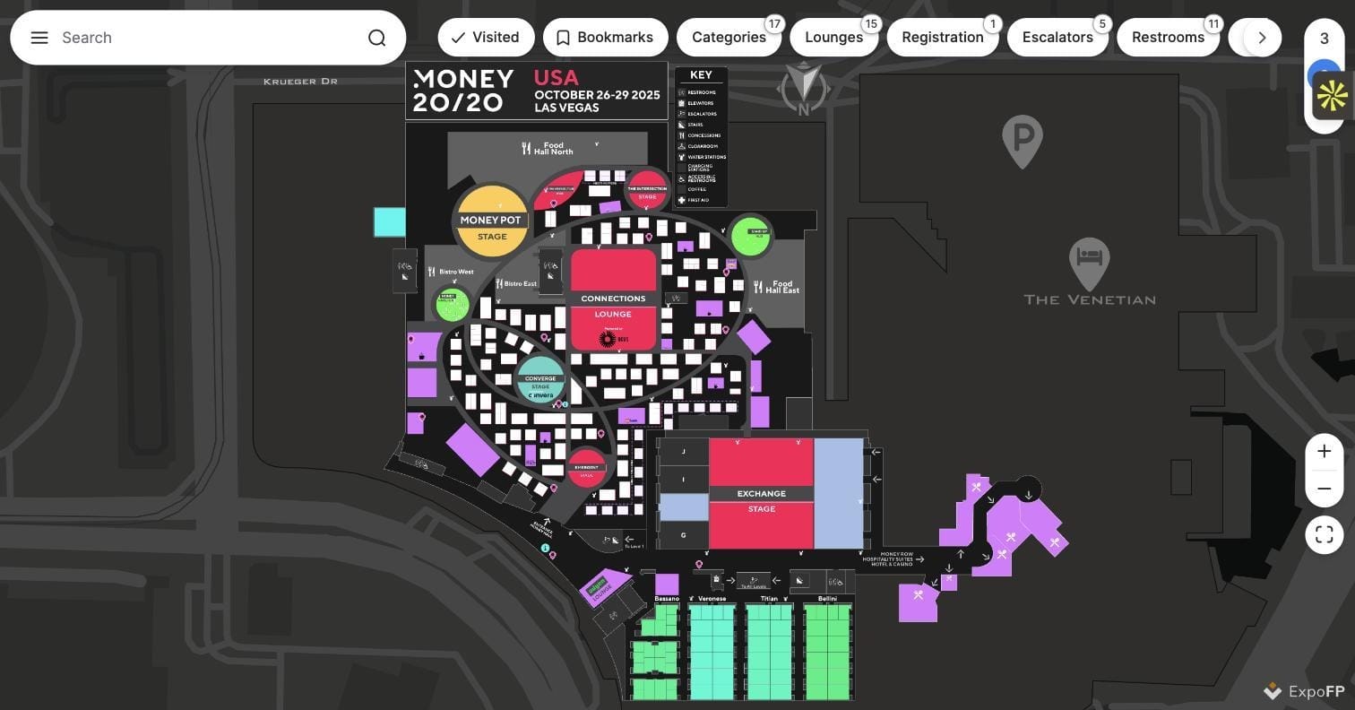
Money20/20 USA expo floor plan — island booths, stages and lounges at The Venetian Expo Las Vegas
Fintech’s flagship event (The Venetian, Las Vegas) doesn’t have rows — it has districts. Four stages (Money Pot, Converge, Exchange, The Intersection), a Connections Lounge in the core, food halls on both flanks, and organically-shaped booth clusters between them, all on a dark map matching the show’s brand.
Why it works: at a summit, the expo floor is the networking venue. Every stage session ends and dumps hundreds of people back through the booth clusters. Copy this: if sponsors buy presence rather than direct sales, design for circulation between content and coffee.
4. AGRITECHNICA — 27 halls, one legible system
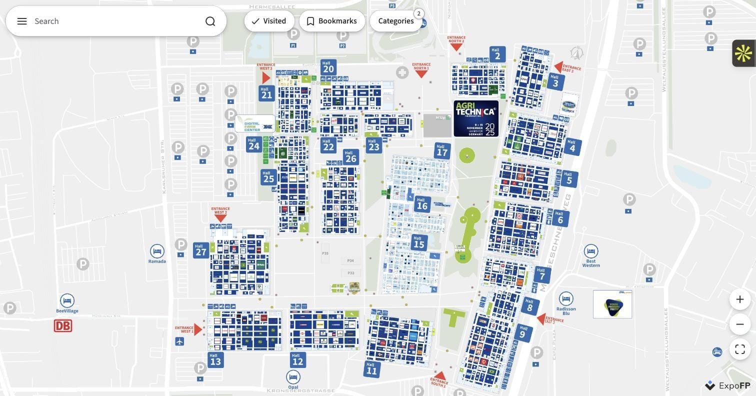
AGRITECHNICA 2025 floor plan example — 27-hall trade fair layout at Hannover Fairground with numbered entrances
The world’s largest agricultural machinery fair (Hannover Fairground, 2,700+ exhibitors) is a city with a metro map: numbered halls 2–27 zoned by product category, six numbered entrances, parking fields, hotels and even the DB rail station on the same map.
Why it works: at this scale nobody “browses” — visitors hunt by category and plan routes in advance. Hall zoning concentrates qualified traffic; mapping transport (entrances, parking, shuttles) is as important as mapping booths.
Copy this: if you’re multi-hall, the map must cover the whole campus, not just the exhibit floors.
5. IFA Berlin — category color-coding across a campus
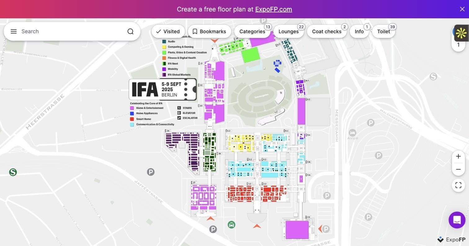
IFA Berlin 2025 floor plan — halls color-coded by product category at Messe Berlin with legend
Europe’s biggest consumer electronics show paints Messe Berlin’s halls by category — Home & Entertainment, Smart Home, Mobility, IFA Next — with the legend right on the map, wrapped around the Summergarten at the center of the campus.
Why it works: color is the fastest wayfinding signal there is; a visitor who knows “audio is dark green” navigates 25 halls without reading a single hall number. Copy this: pick 5–8 zone colors max and put the legend on the map itself.
6. Wine Paris — zoning by geography, not product
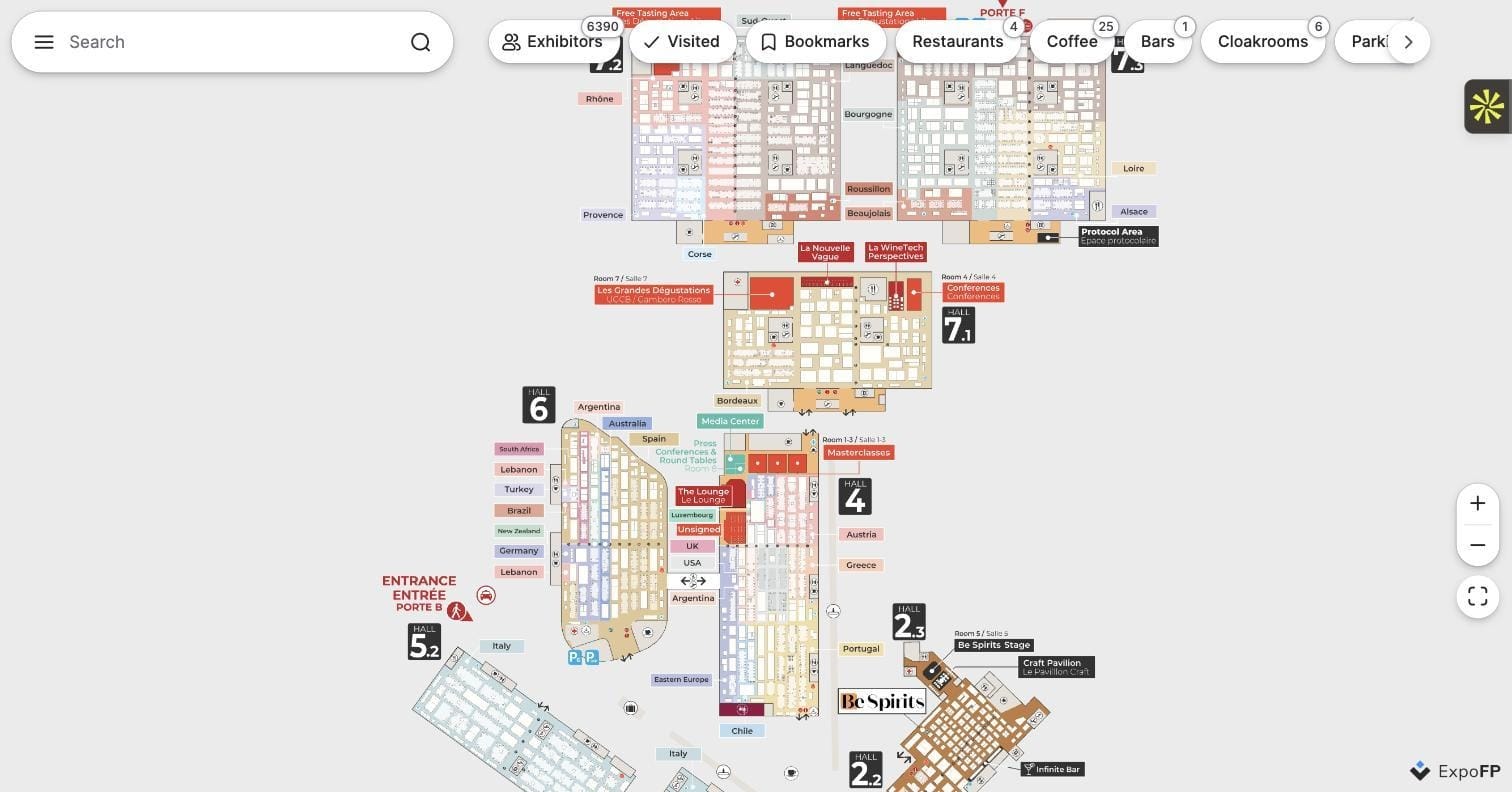
Wine Paris 2026 exhibition floor plan — halls organized by wine region at Paris Expo Porte de Versailles
Wine Paris (Porte de Versailles, 6,390 exhibitors on the map) zones the way its buyers think: by origin. Rhône, Bourgogne, Loire, Alsace upstairs; Spain, Italy, Argentina, USA in Hall 6; masterclass rooms and tasting areas placed between regions as connective tissue.
Why it works: zoning should mirror the buyer’s mental model — an importer shops “Loire vs. Bourgogne,” not “aisle 400 vs. 700.”
Copy this: ask “how do my visitors categorize this market?” before drawing zones.
7. TechCrunch Disrupt — mapping sessions, not just booths
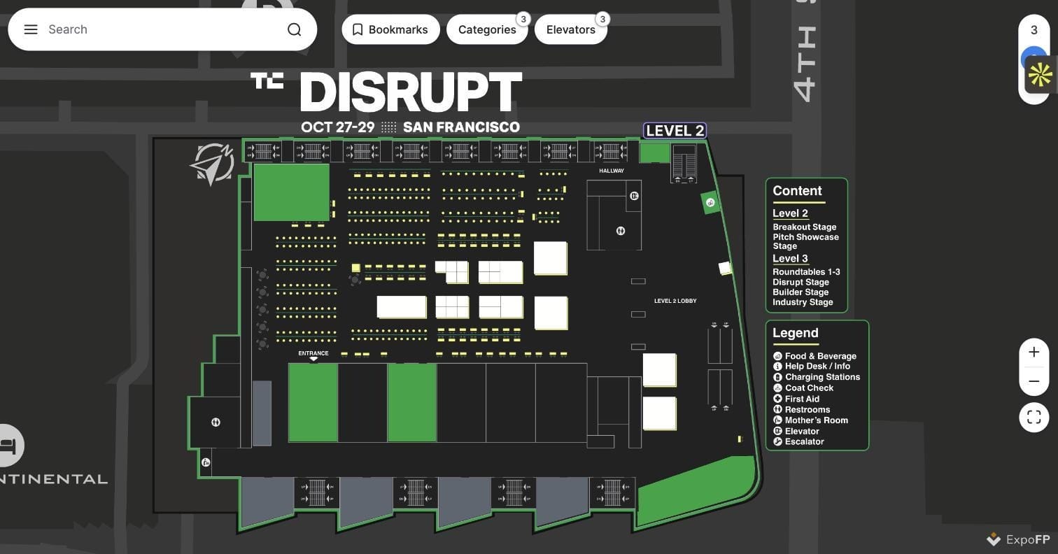
TechCrunch Disrupt 2025 floor plan — multi-level conference layout with stages and roundtables at Moscone West
Disrupt (Moscone West, San Francisco) is a multi-level event where the floor plan carries a “Content” panel per level — Breakout Stage and Pitch Showcase on Level 2, Roundtables and three more stages on Level 3 — plus a legend for services from charging stations to the mother’s room.
Why it works: conference attendees navigate to sessions; putting stages, roundtables and services on the same map as the expo makes it the one tool everyone opens ten times a day.
Copy this: multi-level venues need per-level maps with a level switcher, not one flattened image.
8. Salone Nautico — mapping land and sea
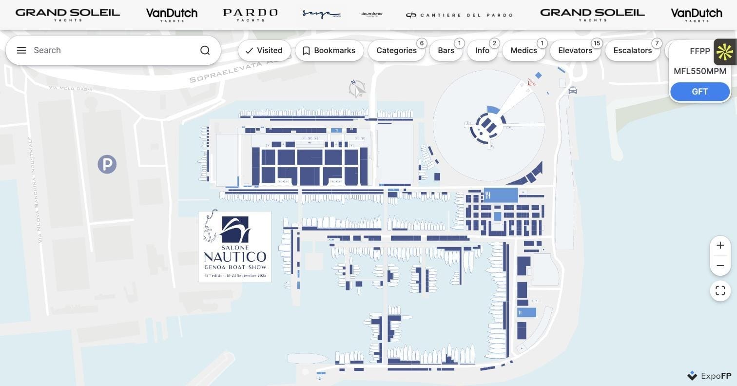
Salone Nautico Genoa boat show floor plan — piers, water berths and pavilions mapped as booths
The Genoa International Boat Show’s venue is half water. The plan treats berths like booths: every yacht mooring along the piers is numbered, searchable and assigned to an exhibitor, alongside shoreside pavilions, bars and 15 elevators.
Why it works: “booth” is an abstraction — anything sellable and findable can be a unit on the map.
Copy this: irregular venue? Don’t force a grid; map the real geography and number it consistently.
9. Motorex2027 — multiple exhibition halls, feature zones and visitor amenities overlaid on satellite imagery
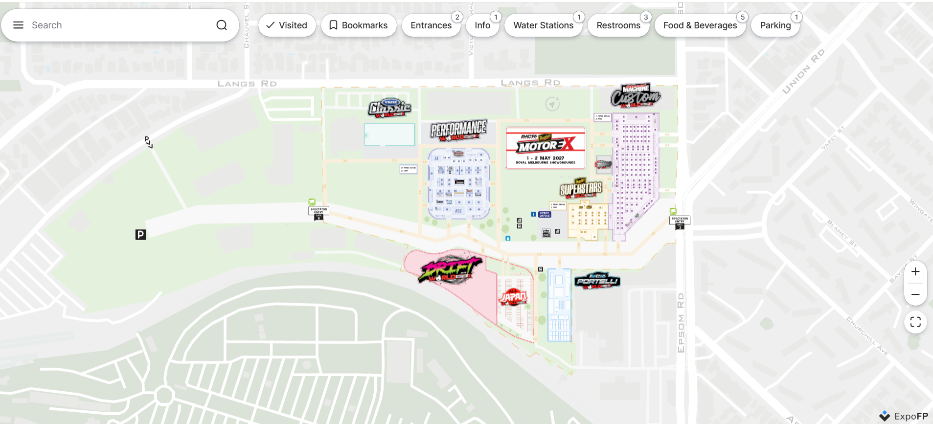
A large outdoor automotive event mapped directly onto satellite imagery, with multiple themed exhibition halls, food & beverage areas, water stations, restrooms, parking, entrances and visitor services clearly distributed across the venue. Each major zone is color-coded and branded, making it easy for attendees to distinguish different event areas at a glance.
Why it works: large outdoor venues can be difficult to navigate because there are few obvious indoor landmarks. Using satellite imagery provides real-world context, helping visitors orient themselves by roads, buildings and open spaces while quickly finding the hall or attraction they're looking for.
Copy this: for motorsport events, expos and multi-zone outdoor shows, combine satellite imagery with color-coded sections and clearly marked amenities for intuitive navigation.
10. The ExpoFP demo — the business layer made visible
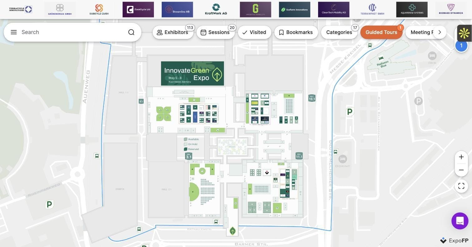
Interactive floor plan demo with booth sales statuses — Available, On Hold, Reserved
Our own demo plan (a fictional expo at Koelnmesse) shows the layer most floor plans hide: live booth status — Available, On Hold, Reserved — right in the legend, plus shuttle routes, guided tours and session listings.
And this is what a visitor gets when they tap any booth:
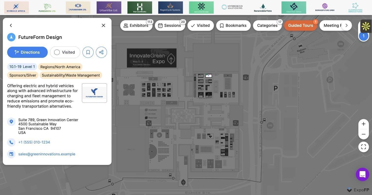
Exhibitor card on an interactive floor plan — profile, booth number, categories and Directions button
Profile, booth number, categories, contacts — and a Directions button that routes them across the venue.
Why it works: when the sales map and the attendee map are the same map, it never goes stale, and every viewer sees live truth.
Copy this: open the demo and click around — then build yours.
Build your own in minutes
Browse 1,000+ more real floor plans for inspiration, or start drawing: Create your floor plan free → — or upload your PDF/CAD and we’ll convert it.
FAQ
What is a trade show floor plan? A scaled map of an event venue showing booths, aisles, stages, entrances and services. Modern plans are interactive: searchable, mobile-friendly and connected to booth sales and analytics.
What is the most common floor plan layout? The grid — parallel aisles of inline booths (see EXHIBITORLIVE above). It scales from 50 to several thousand booths and stays easy to navigate.
How do I choose a layout for my event? Match attendee behavior: browsing shows suit grids and zoned neighborhoods; B2B fairs benefit from category or region zoning; conference expos need stages, lounges and wide circulation.
Where can I see more real floor plan examples? ExpoFP publicly hosts interactive plans for thousands of events — browse them at expofp.com/venues.
Further reading: How to Create a Trade Show Floor Plan · Trade Show Booth Types · Trade Show Booth Sizes & Dimensions